Composite Map of Tolkien's Arda
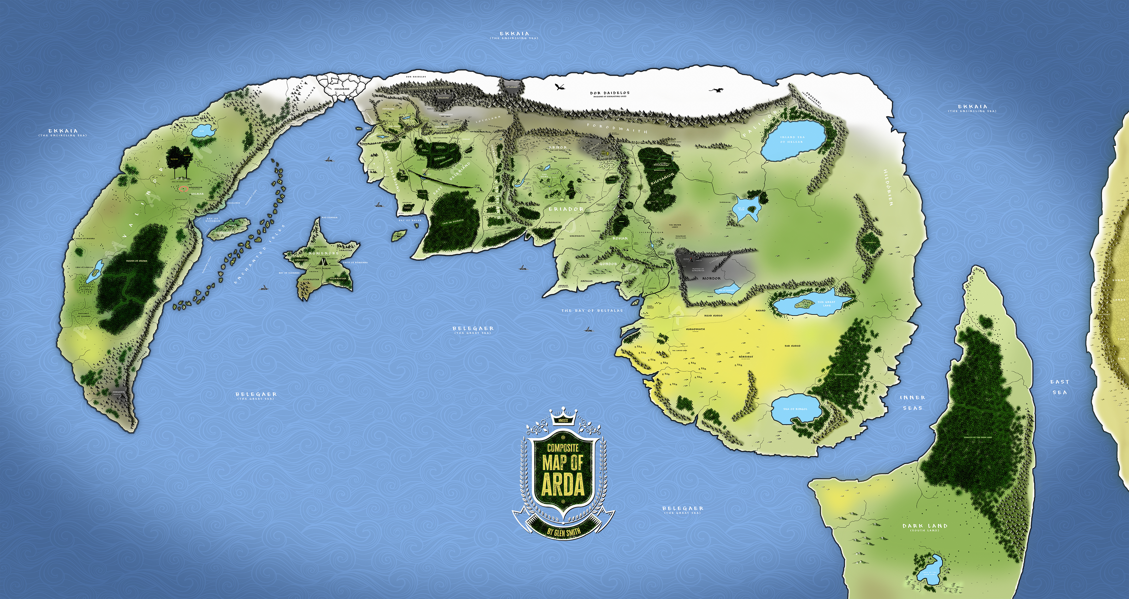
I have recently completed a project which was long on my mind to do. Since I began seriously reading Tolkien a few years ago, reading The Silmarillion, the Fall of Gondolin, the Lost Tales etc, and after of course having read The Hobbit and LOTR in my youth and then re-reading them again repeatedly, I was frustrated by the fact that there were no original maps which clearly showed how Beleriand and Middle Earth were related geographically, and I spent a lot of time trying to understand their relationship, as Tolkien never really showed this in his original maps.
So I began creating my own map, dealing with a number of discrepancies which required creative thinking to overcome. Gradually, by overlaying, stretching and distorting Tolkien's own maps, and filling in between with other expert sources, I had something that resolved the question for me. For instance I ignored the southward-extending coastline shown in the Fonstad maps, based in turn on Tolkiens own indicative sketches of early Arda, so that I could depict the Eriador and Gondor coastlines in a way recognisable to readers of the LOTR and the Silmarillion - including the coastline forming north coast of the Great Gulf would have made the map more confusing for those unfamiliar with The Atlas Of Middle Earth. But then the question of where Aman was placed in relation to my map, and then Numenor, and then on and on through the historical lands of the Silmarillion and the Lost Tales. So eventually I had created this map, which of course makes a huge number of assumptions and makes use of a lot of artistic license, but I have tried to incorporate as many place names and geographical features as I could find, either in maps or in text descriptions.
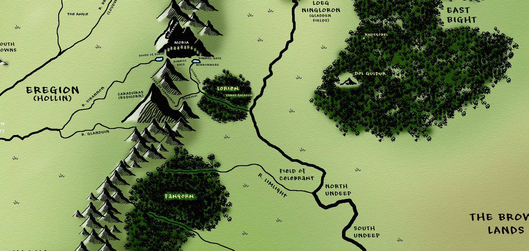
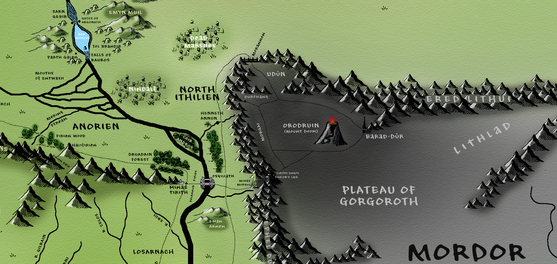
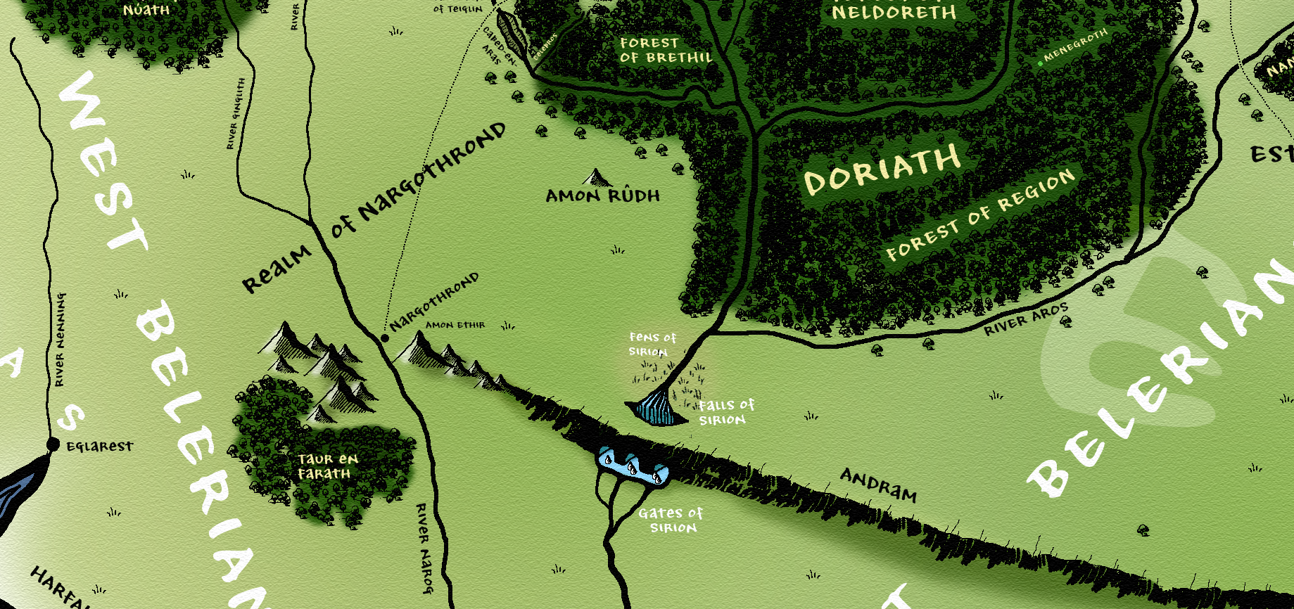
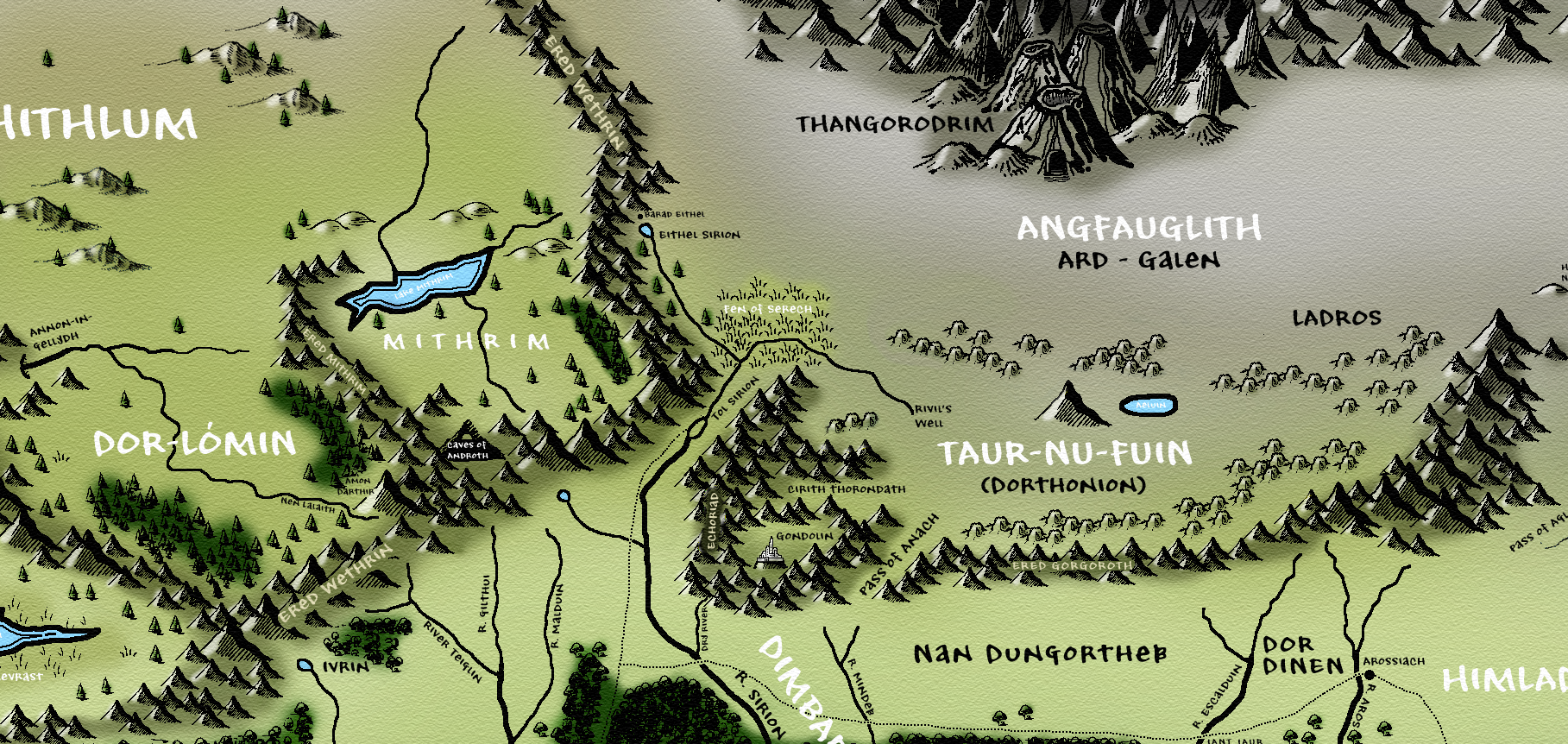
Some close-up shots of the map showing the level of detail.
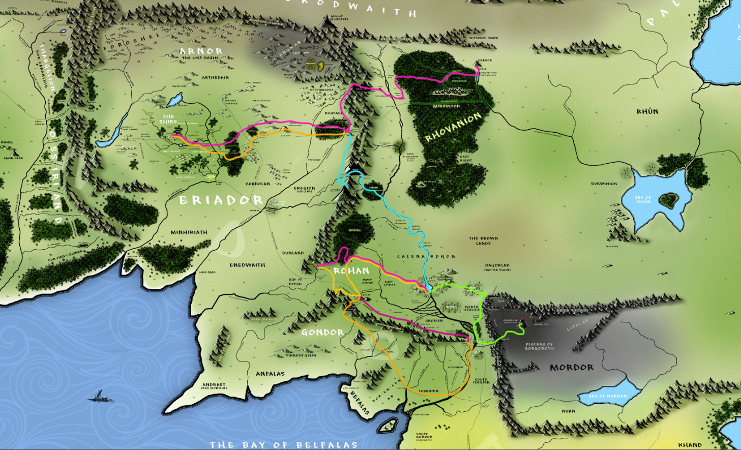
The routes of the various journeys undertaken by the main protagonists in The Hobbit and Lord Of The Rings
This short film attempts to show the depth of detail the map goes into at full resolution.
I have shared it to a number of Tolkien communities, and the reaction has generally been positive, although of course purists and the self-appointed gatekeepers of Tolkiens canon have, and will continue to, reject it as ‘inaccurate' 'blasphemous' and ‘just plain wrong-headed’. But it does fulfil a purpose, to create a general idea of where everything was in relation to everything else over the thousands of years of Tolkien's universe, despite many of these places never existing in Arda simultaneously. Somebody commented that it was like attempting to make an historical map of earth combining Pangea and the modern world as we know it, and it is a pretty accurate criticism, but nevertheless here it is. Others have said it is just David Day’s lungs map 2.0, but I believe it is more than that. The original map is 23,959 x 12,722 pixels at 300 dpi and impossible to display online at anything like full resolution - and I have myself printed out and framed a version measuring 70 x 35 cm, and at that size many of the details are too small to see. A full-size hi-res png is available for download below for those who would like to make a donation. Thanks!